


Rock an Torabh Walk

mlmoroneybb
User


2h18
Difficulty : Medium

FREE GPS app for hiking
 SityTrail
IGN / Geographical institutes
SityTrail Plus
The world is yours!
About
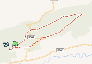
Trail Walking of 8.1 km to be discovered at Unknown, County Tipperary, The Municipal District of Cahir — Cashel. This trail is proposed by mlmoroneybb.
Description
A-B. From the mapboard in the green area climb onto the road and go to the Christ the King statue. Follow the red arrow and enter the forestry at the barrier. Note that you are also following blue arrows which are for the longer Millenium Stone Loop. After 50m you reach a Y-junction where the BLUE loop veers right and downhill – but you continue straight following the red arrow.
B-C. You are now on a forestry roadway. Continue to follow the red arrows along this roadway for 2km to reach a crossroads you rejoin the BLUE loop as it makes its way back from the Millenium Stone. Turn sharp left here.
Positioning
Comments